|
||
|
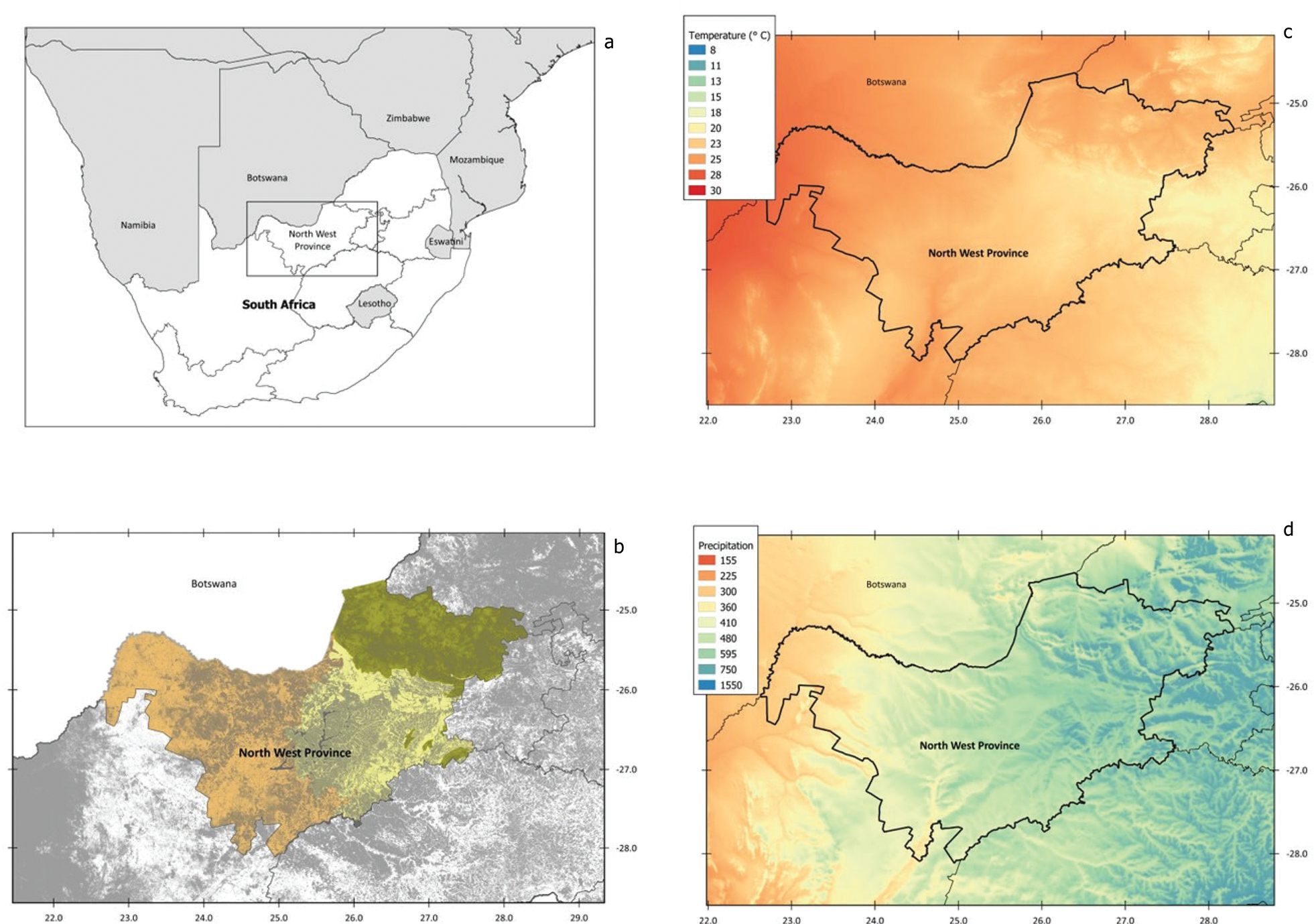
a. Location of North West Province, South Africa; b. Ecoregions (orange: western arid Kalahari, yellow: southern Highveld grassland, green: eastern mesic Bushveld, superimposed by the degree of habitat transformation as of 2019 (grey); c. Average temperature of warmest quarter (°C; bio10); d. Annual precipitation (mm/year; bio12). Environmental data from CHELSA (http://chelsa-climate.org/) and land cover data from South African Department of Forestry, Fisheries and Environment (https://egis.environment.gov.za/sa_national_land_cover_datasets). Polygons within South Africa show provincial borders. |