|
||
|
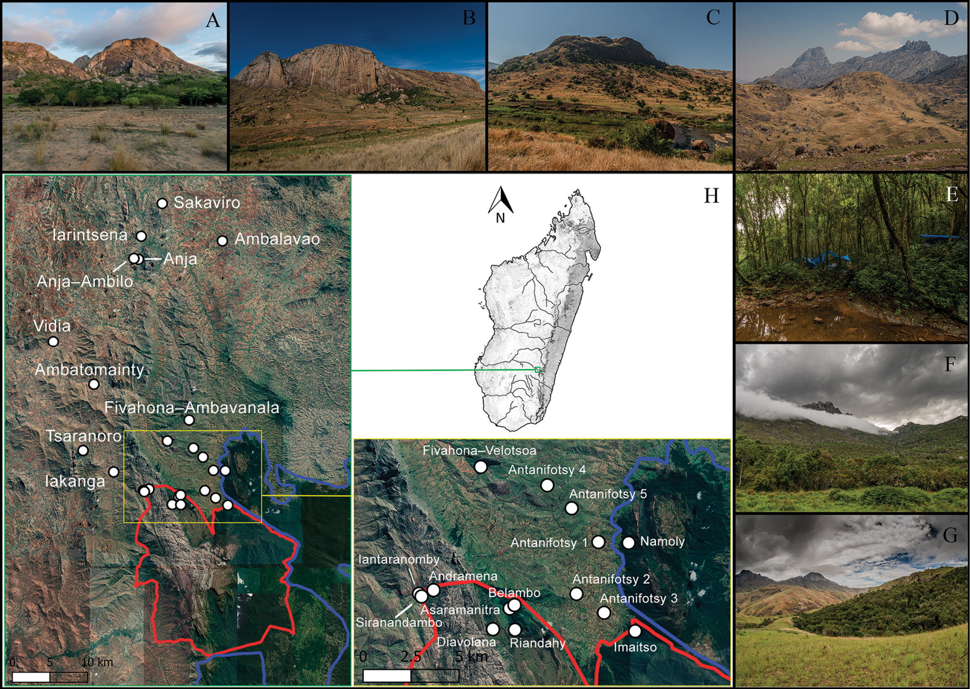
Map of the study area and sampling sites. The borders of Andringitra National Park (red) and Paysage Harmonieux Protégé du Corridor Forestier Ambositra–Vondrozo (Ambositra–Vondrozo Forest Corridor) (blue) are shown. See Suppl. material 1: Table S1 for more details on the sampled localities. Map data ©2015 Google (QGIS Development Team 2020). ANP ES – Andringitra National Park Eastern Slopes; ANP WS – Andringitra National Park Western Slopes. A. Anja; B. Sakaviro; C. Ambatomainty; D. Western slopes of the Andringitra Massif from Iantaranomby (ANP WS); E. Imaitso (ANP ES); F. Belambo (ANP ES); G. Fivahona–Velotsoa; H. Map with sampling sites. Photographs by Javier Lobón-Rovira. |