|
||
|
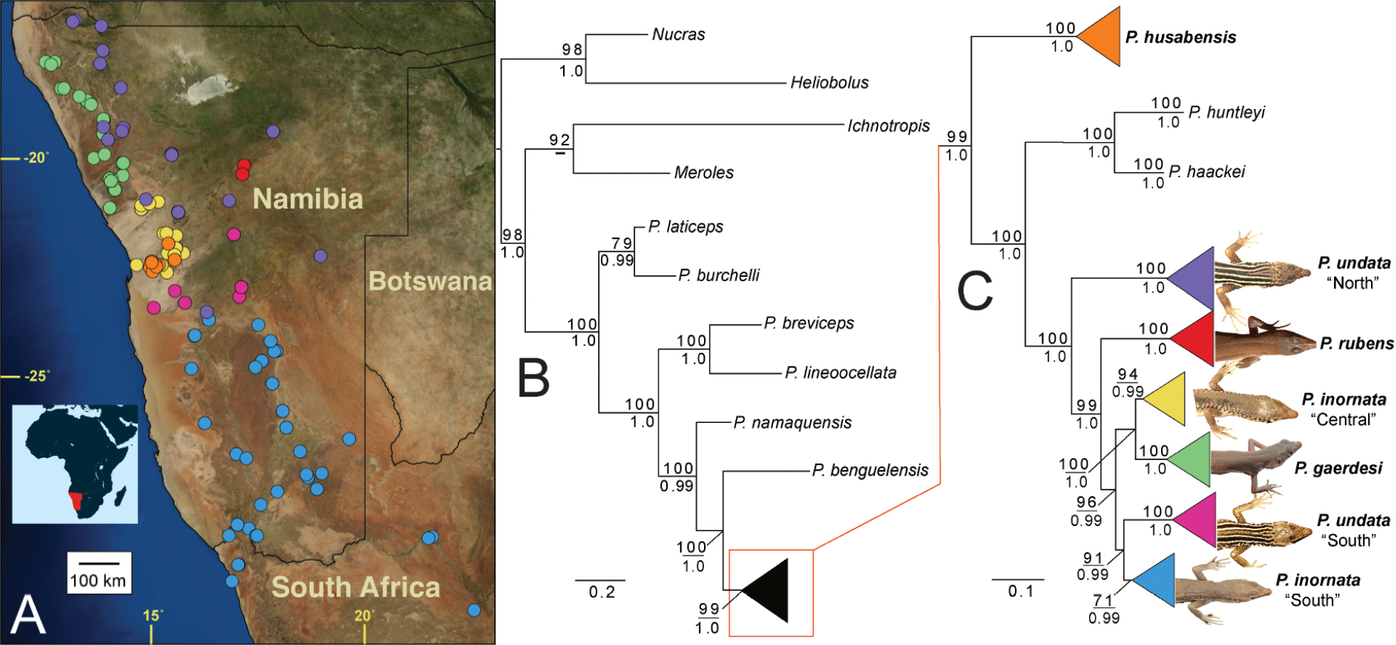
Sampling map and phylogeny of Pedioplanis. (a.) Satellite map of Namibia depicting sampling localities for genotyped specimens of P. husabensis and the six major clades within the P. undata species complex recovered by maximum likelihood and Bayesian analysis of the concatenated mitochondrial dataset. (b, c.) Maximum likelihood phylogram depicting (b.) the interspecific phylogenetic relationships among all Pedioplanis species and (c.) all major clades within the P. undata species complex; colored triangles indicate multiple sequenced individuals; typical dorsal patterning for each member of the complex is shown based on photographs of live individuals and museum vouchers. Bootstrap values (above) and posterior probabilities (below) are provided for each major node. Satellite map of Namibia and surrounding countries created by using the Google Maps terrain map layer, which was accessed through the Free and Open Source QGIS (QGIS.org 2021) and its OpenLayers Plugin. |